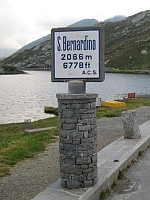
Location:  Route 13 Splugen to Mesocco (26 miles)
Coordinates: 46.4961216,9.1707471
Ridden: 2010
 From Splugen you can only follow the old road a little way before it is entirely subsumed by the new road, which you have to join. When you are past Hinterrhein take care to follow the Blue sign to “San Bernardino Pass” not the Green sign to “San Bernardino”. The latter takes you through the new tunnel. The old pass starts immediately by the tunnel entrance. A series of tight, often blind, hairpins takes you to the plateau above where you then climb gently to the refugio at the summit, next to a lake. The ascent from the tunnel entrance is only 5.5 miles at an average of 5.1%. The descent is nice as the hairpins are more open and you get more opportunity to plot your line. 3,000 feet lower down and you arrive at San Bernardino. You can then continue on the old road to Mesocco or, if you’re short of time, get on the new pass road. This is actually good fun as its well cambered and surfaced so you can get a wriggle on if you can avoid getting stuck behind the HGVs and campervans. If you approach from the south you’ll be coming from Bellinzona. There’s no point in using the old road. Stay on the new road – the A13/E43 until Mesocco when you can get off and rejoin the pass road to San Bernardino and beyond to the summit. The ascent from Mesocco is 12.5 miles at an average of 4.5%. A good pass either way you ride it but overall more fun if you approach from the south.
